WESTERN NEWFOUNDLAND
The Great Northern Peninsula is the northernmost visible extension of the Appalachian Mts. The Viking Trail-Route 430 & its side roads snakes along its western coast through Gros Morne National Park, fjords, sand dunes, &small communities
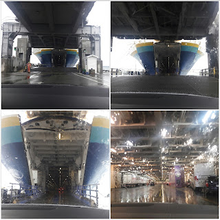
We had to take a 6 hour Ferry from North Sydney to Port Aux Basques which also transports your vehicle. The route to the right is 16 hours long!! Your charged per passenger & per foot of your vehicle$%&*
Here's our ferry!!
Okay time to load up!!! Here we go!!!
Now that we're on the ferry we look for exit signs AND motion sickness bags!!
Found them!!!
We made it!!!! First thing we had to do was adjust to the time change. They have their own time zone-Newfoundland Standard Time- a half hour ahead of the other Atlantic provinces. When time zones were established, the Dominion of Newfoundland was an independent country with its own time zone. The government tried to make the province confirm to Atlantic Standard in 1963, but the Newfies wanted no part of that! So they remain the first people in Canada to welcome the New Year!
First thing we noticed Moose signs every few miles..I'm sorry it's kilometers
The first introduction in 1878 involved 2 moose released to the Gander Bay area. In 1904 additional 4 moose were introduced. Moose on the island have no significant predator such as wolves.The moose population was allowed to expand without targeted hunting until 1935. By the mid 90's the population had increase to 140,000+!! It has decreased since then to about 112,000+ due to a decrease in available food resources.
How many did we see??? TWO..... a bull hit by a semi just minutes in front of us...dead & one on a hike. That's it!!!
Our view driving the highway " Long Range Mountains"
Stretching all the way from the southwest coast to the Northern Peninsula, a distance of about 400km(250 miles). They form the northernmost extent of the Appalachian Mountains.
We drove through beautiful green valleys and then we saw this!
This is called "Tablelands", a unique rock massif that was forced up to the surface millions of years ago during a plate collision. It's rocks are toxic to most plants & have weathered to a rusty brown color. It provides a remarkable exposure of mantle rock, rarely seen at the earth's surface.
They say its like walking on Mars
So we did a 4km = 2.48 mi hike
While there we saw the rock piles that you see throughout Canada. They are called " Inukshuk", meaning " likeness of a person". Purpose : to show directions to travelers. to warn of impending danger, to mark a place of respect. These days they are often whimsical creations built as a way of saying howdy or perhaps merely " I was here"!!
Our first sunset in Newfoundland facing the Gulf of Lawrence
Ok no resting here! We have to go do some hiking. We head towards the northern tip to St. Anthony which is on the Atlantic Ocean side.
As you can see we have choices on different hikes. We picked the RED one with the steps!!!
Daredevil Trail with 476 steps straight up!!! Elevation 550 ft
The middle left picture is at the bottom looking UP!!!
We're almost there !!!
We MADE it!!!!
Our view zoomed in
Our view without it
Shrimp boat going out to sea
View of the village
Iceberg!! I would of had a better picture but we left our good camera back in the car....sooo that means that one of us(probably me) would have to go down the 476 steps AND back up the 476 steps. The total would of been 1904 STEPS!! So use your good eye! We also saw whales but we're back to 1904 STEPS! Trust me!!!
Okay which way should we go?????
Time to go down!!!
At the tip of the peninsula, the Vikings established the first European settlement in North America a thousand years ago. Under Leif Eiriksson's leadership, the group of 60-90 people set up a sturdy camp of turf walled buildings as an over wintering base for exploring to the south.
L'Anse aux Meadows National Historic Site
We met a loving Viking couple Bjorn & Thora who welcomed us into their sod hut
Okay back to hiking another day in Gros Morne National Park
This one claims to be gentle, we can do this. Wait it's 9.2 km=5.71 miles!!
After we saw this sign we saw a moose on a clear hill!! Yeah we saw a live moose!!!
Berries on the trail
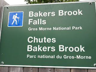
We made it to the falls
Waiting for the bus to pick us up. WAIT... we have to hike back!!!!
WESTERN BROOK POND
A Canadian landlocked fjord
You have to hike 45 minutes (3km-1.9 mi)to the boat dock. Cliffs rise 2000 feet on both sides of the gorge carved from the surrounding plateau by glaciers. After the glaciers melted, the land rebounded & the fjord was cut off from the sea. Salty water was eventually flushed from the fjord leaving it fresh.
Views along our journey
This was interesting! The land around the homes are limited so they are able to grow their gardens along the roads out in the middle of no where! They also apply for a permit to gather wood. They cut in the winter & bring it out towards the road on a sleigh. In the summer you go get it & take it home!
An old fishing camp but what a VIEW
Met a local man & told us about the fishing industry or should I say lack of industry.
He wrote this story
More views in our journey
Our trip from North Sydney, Nova Scotia via ferry 178km-110.6 miles
to Port aux Basques, Newfoundland.
The Port to St. Anthony & in between back to the Port 2080.8km-1293 miles
Our last night sunset
Saw this on a menu & thought "what a proper ending to this journey"


No comments:
Post a Comment